| Project name | ForSens: Development of a scalable method for the determination of forest parameters using satellite remote sensing and deep learning methods |
|---|---|
| Acronym | ForSens |
| Project partner |
|
| Grantor | State of Hesse, LOEWE-SME-Collaborative project (funding line 4) |
| Duration | 01.09.2022-31.08.2024 |
| Project content |
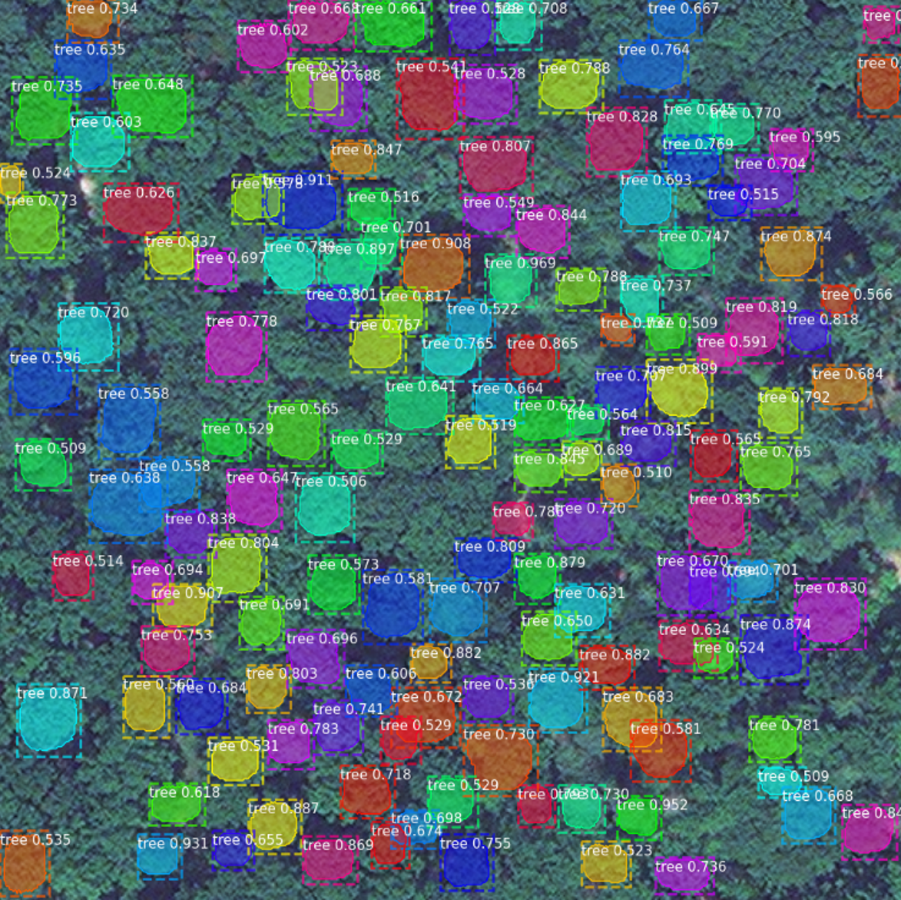
A comprehensive and highly detailed mapping of the forest stand as well as a precise determination of individual tree parameters, such as the tree species or tree canopy diameter, is the basis for sustainable and location-adapted forest management. The goal of the research project is the investigation of a method, which enables the simultaneous detection and spatial delineation of individual tree crowns and tree crown areas from satellite images. In addition, other characteristics such as tree species and canopy health should be assigned to each individual tree in the study area as well as a method for estimating the biomass on an individual tree level will be explored. The results of the project can provide an effective, low-cost and AI-based alternative to current forest mapping methods. |
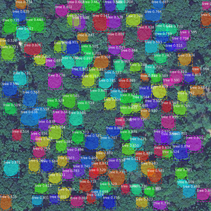
KI-based tree crown delineation
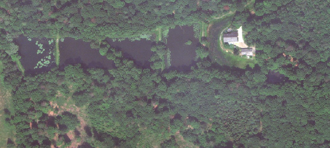
Very high-resolution WorldView-3 Satellite Images